Skip to main content
Main navigation
News
Events
Exhibitions
1846: Inventing Americana at the John Carter Brown Library
Simon Bolivar, The Libertador
Upcoming Events
Past Events
Research
Using the Library
Instructional Support Guide
Requesting Materials
Resources and Publications
Image Permissions & Requests
Catalog
Fellowships
Opportunities
Fellows Directory
Life in Residence
Remote Fellowship Program
Visit
Visiting the JCB
Requesting Materials in the Reading Room
Collection Highlights
Places
Languages
Themes
Periods
Genres
About
Mission
Initiatives
History
People
Leadership
Staff Directory
Toggle Search
Search
Search
Search Menu
Online Catalogue (BruKnow)
Place
North America
Share
Facebook
Twitter
Email
Featured Items
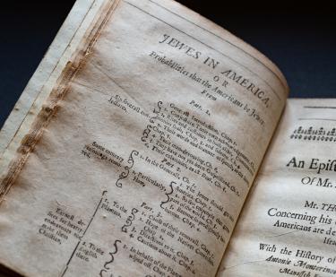
Jewes in America. Part 1
Thomas Thorowgood
1652
Enseñar desde luego silabeando
Jose de Nava
1802
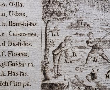
La istoria de las Indias. y Conquista de Mexico
López de Gómara
1552
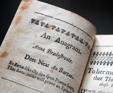
The tenth muse lately sprung up in America
Anne Bradstreet
1650
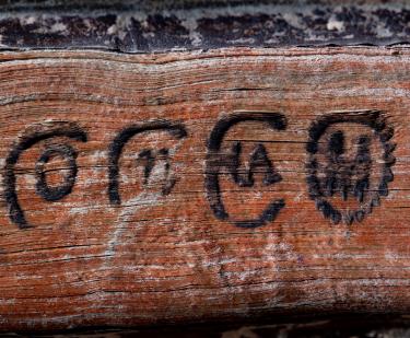
Aqui comiença vn vocabulario en la lengua castellana y mexicana,
Alonso de Molina
1555
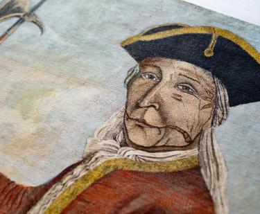
The brave old Hendrick the great Sachem or Chief of the Mohawk Indians...
1740
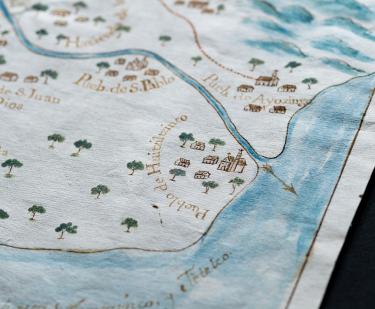
El presente mapa demuestra la cituacion, plano, y repartimiento, que en la actualidad tienen los arroyos, que bajan de Sierra Nevada…
Felipe de Zúñiga y Ontiveros
1770
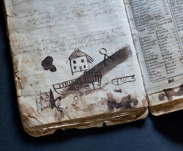
Diary of Captain Samuel Tillinghast
Samuel Tillinghast
1761-1766
Show More
See Also
Book
Asia