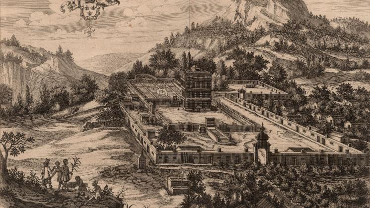
A View of Slave Cabins on the Margins

This image is a plate from “Paysage d’une partie de l’Ile de S. Christofle, avec un Crayon du Chasteau de Mr. le General” from Charles de Rochefort’s Histoire naturelle et morale des iles Antilles de l’Amerique (Rotterdam: 1681). John Carter Brown purchased the book in 1854 from his preferred vendor, Henry Stevens, and is featured in the Library’s “Rooms of their Own” exhibition.
The most frequent visual depictions of enslaved peoples' dwellings appear in surveys, plans, images and maps created by Europeans. These works documented the development of Creole colonial life in slave-based societies in the Americas and described the indigo, coffee, and sugar industries these societies were devoted to. Slaves’ dwelling places are shown in proximity to the activities of plantations, to the houses of slaveholders and overseers, and sometimes to secondary subsistence agricultural fields. Slaves’ dwellings being fixed in space reveals their primordial importance and their relegation to the margins, away from public view and public practices of power. This plate is a perfect illustration of these spatial hierarchies.