
Main navigation

  • News
  • Events
    • Exhibitions
      • 1846: Inventing Americana at the John Carter Brown Library
      • Simon Bolivar, The Libertador
    • Upcoming Events
      • Past Events
  • Research
    • Using the Library
      • Instructional Support Guide
      • Requesting Materials
      • Resources and Publications
      • Image Permissions & Requests
    • Catalog
    • Fellowships
      • Opportunities
      • Fellows Directory
      • Life in Residence
      • Remote Fellowship Program
  • Visit
    • Visiting the JCB
      • Requesting Materials in the Reading Room
    • Collection Highlights
      • Places
      • Languages
      • Themes
      • Periods
      • Genres
  • About
    • Mission
      • Initiatives
      • History
    • People
      • Leadership
      • Staff Directory

Search Menu

  • Online Catalogue (BruKnow)

Language

English

  • Facebook
  • Twitter
  • Email

Featured Items

Detail of an engraved map of Azilia shows a castle in the center of the city, surrounded by farms and four quadrants.

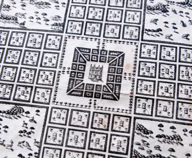
A plan representing the form of setling the districts, or county divisions in the Margravate of Azilia

1717
Detail of an engraved map of northeastern North America shows "Maryland," "Virginia," and other labels in English for forts and bodies of water.

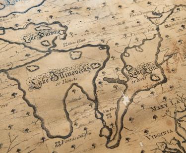
[A new chart of the English Empire in North America]

Cyprian Southack
1717
Detail of a printed book shows title page with English text "The English Pilot. The Fourth Book describing the West India Navigation, from Hudson's Bay to the River Amazones" in red ink.

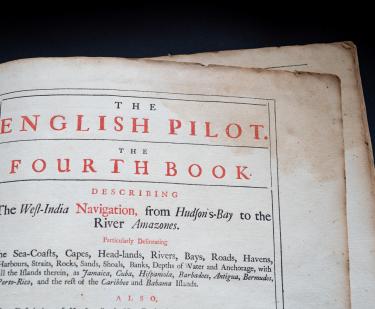
The English pilot, Book 4

William Fisher; John Thornton
1745
Detail of a colored manuscript chart shows a small cluster of homes and palm trees with text in English reading "Indian Village of Sancopana."

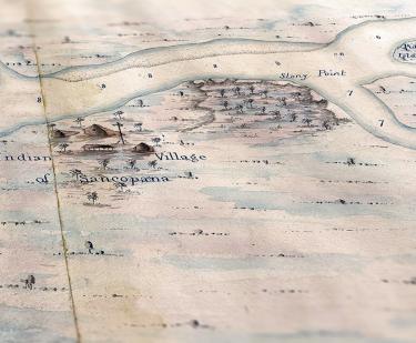
An actual survey of the River Orinoco from the great mouth up to the City of Angostura

1803
Detail of an engraved map shows people standing around a tent that is surrounded by a grid layout.

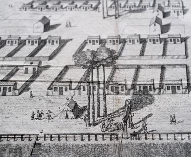
A View of Savanah as it stood the 29th of March. 1734

Peter Gordon
1734
Detail of a printed text shows an astronomical circular diagram and text in English.

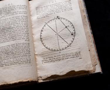
An account of the observation of Venus upon the sun...

Benjamin West
1769
Detail of engraved, hand colored print of Quebec City shows fortifications, churches and cathedral, statehouse, ships, and dwellings. Also includes title reading "Quebec, the Capital of New France" and other text in English.

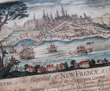
Quebec: The Capital of New France

Thomas Johnston
1759
hand colored map of north America

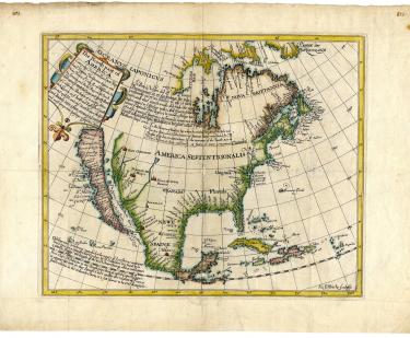
The north part of America...

Henry Briggs
1625
  • Show More

See Also

Atlas

Latin

Back to top

Location

The John Carter Brown Library
94 George Street
Providence, Rhode Island 02906

contact@jcblibrary.org
Directions & Contact

Hours

Hours & Closings

Newsletter

Sign up to receive the latest news, events, and highlights from the JCB.

Sign Up


  • Accessibility
  • Facebook
  • Twitter
  • Instagram
©2024 The John Carter Brown Library. A Message»Agency Site