Skip to main content
Main navigation
News
Events
Exhibitions
1846: Inventing Americana at the John Carter Brown Library
Simon Bolivar, The Libertador
Upcoming Events
Past Events
Research
Using the Library
Instructional Support Guide
Requesting Materials
Resources and Publications
Image Permissions & Requests
Catalog
Fellowships
Opportunities
Fellows Directory
Life in Residence
Remote Fellowship Program
Visit
Visiting the JCB
Requesting Materials in the Reading Room
Collection Highlights
Places
Languages
Themes
Periods
Genres
About
Mission
Initiatives
History
People
Leadership
Staff Directory
Toggle Search
Search
Search
Search Menu
Online Catalogue (BruKnow)
Language
French
Share
Facebook
Twitter
Email
Featured Items
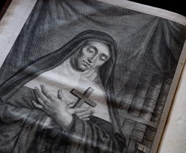
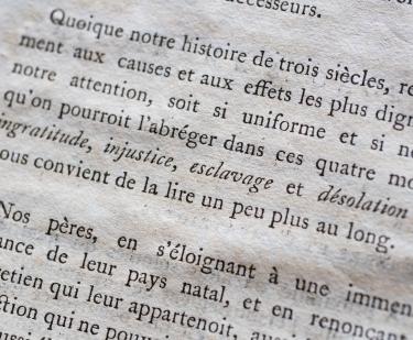
La vie de la venerable mere Marie de l'Incarnation premiere superieure des ursulines de la Nouvelle France
Claude Martin
1677
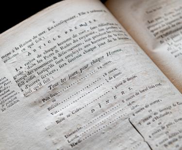
Composition de la ration des gens de mer
French Admiralty
1785
Lettres d'une Peruvienne
Françoise de Graffigny
1748
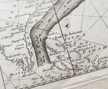
The Gulf Stream flowing northwards…
Benjamin Franklin
1778
Lettre aux Espagnols-Américains
Juan Pablo Vizcardo y Guzman
1799
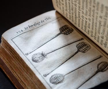
Du Bon usage du thé, du caffé et du chocolat pour la preservation & pour la guerison des maladies.
Nicolas de Blegny
1687
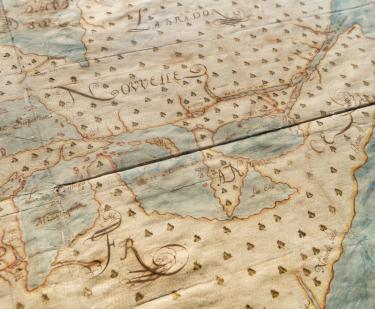
Nouvelle Découverte de plusieurs Nations Dans la Nouvelle France en l'année 1673 et 1674
Louis Joliet
1673-1674
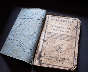
Calendrier pour l’année 1807
1806-1807
Show More
See Also
Religious Cultures
Book