Skip to main content
Main navigation
News
Events
Exhibitions
1846: Inventing Americana at the John Carter Brown Library
Simon Bolivar, The Libertador
Upcoming Events
Past Events
Research
Using the Library
Instructional Support Guide
Requesting Materials
Resources and Publications
Image Permissions & Requests
Catalog
Fellowships
Opportunities
Fellows Directory
Life in Residence
Remote Fellowship Program
Visit
Visiting the JCB
Requesting Materials in the Reading Room
Collection Highlights
Places
Languages
Themes
Periods
Genres
About
Mission
Initiatives
History
People
Leadership
Staff Directory
Toggle Search
Search
Search
Search Menu
Online Catalogue (BruKnow)
Place
North America
Share
Facebook
Twitter
Email
Featured Items
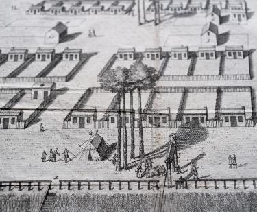
A View of Savanah as it stood the 29th of March. 1734
Peter Gordon
1734
Neptune Americo-Septentrional contenant les côtes, les et bancs, les baies, ports, et mouillages,...
Buache de la Neuville
1780
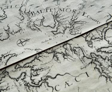
Virginia and Maryland As it is planted and Inhabited this present Year 1670
Augustine Herrman
1673
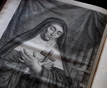
La vie de la venerable mere Marie de l'Incarnation premiere superieure des ursulines de la Nouvelle France
Claude Martin
1677
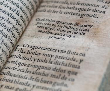
Secretos de chirurgia
Pedro Arias de Benavides
1567
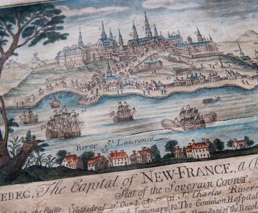
Quebec: The Capital of New France
Thomas Johnston
1759
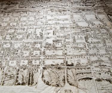
Ordenanza que para la division de la m. noble y leal ciudad de Santiago de Queretaro en cuarteles menores, creacion de alcaldes de ellos, y reglas para su gobierno.
1796
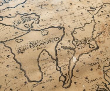
[A new chart of the English Empire in North America]
Cyprian Southack
1717
Show More
See Also
17th Century
Italian