Skip to main content
Main navigation
News
Events
Exhibitions
1846: Inventing Americana at the John Carter Brown Library
Simon Bolivar, The Libertador
Upcoming Events
Past Events
Research
Using the Library
Instructional Support Guide
Requesting Materials
Resources and Publications
Image Permissions & Requests
Catalog
Fellowships
Opportunities
Fellows Directory
Life in Residence
Remote Fellowship Program
Visit
Visiting the JCB
Requesting Materials in the Reading Room
Collection Highlights
Places
Languages
Themes
Periods
Genres
About
Mission
Initiatives
History
People
Leadership
Staff Directory
Toggle Search
Search
Search
Search Menu
Online Catalogue (BruKnow)
Theme
Maritime History
Share
Facebook
Twitter
Email
Featured Items
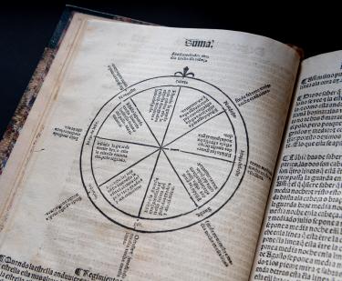
Suma de geographia...
Martin Fernandez de Enciso
1546
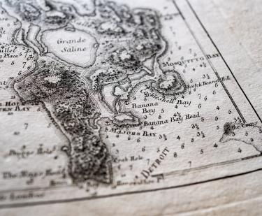
Pilote americain septentrional
Georges-Louis Le Rouge
1778-1789
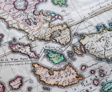
Carte Hydrographique & Chorographique des Isles Philippines…
Pedro Murillo Velarde
1760
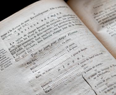
Composition de la ration des gens de mer
French Admiralty
1785
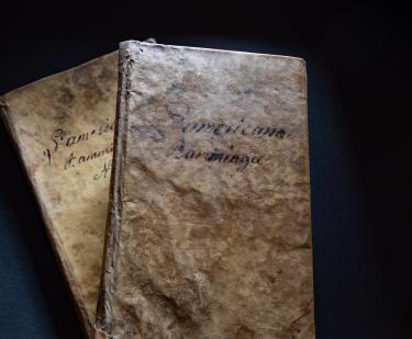
L'Americana Ramminga
Pietro Chiari
1764
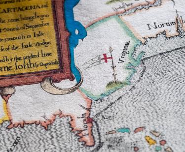
The famouse West Indian voyadge made by the Englishe fleete of 23 shippes and Barkes wherin weare gotten the townes of St. Iago, Sto. Domingo, Cartagena and St. Augustines
Baptista Boazio
1589
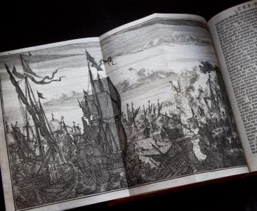
De Americaensche zee-roovers
Alexandre Olivier Exquemelin
1678
See Also
Black History
German