Skip to main content
Main navigation
News
Events
Exhibitions
1846: Inventing Americana at the John Carter Brown Library
Simon Bolivar, The Libertador
Upcoming Events
Past Events
Research
Using the Library
Instructional Support Guide
Requesting Materials
Resources and Publications
Image Permissions & Requests
Catalog
Fellowships
Opportunities
Fellows Directory
Life in Residence
Remote Fellowship Program
Visit
Visiting the JCB
Requesting Materials in the Reading Room
Collection Highlights
Places
Languages
Themes
Periods
Genres
About
Mission
Initiatives
History
People
Leadership
Staff Directory
Toggle Search
Search
Search
Search Menu
Online Catalogue (BruKnow)
Period
18th Century
Share
Facebook
Twitter
Email
Featured Items
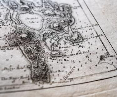
Pilote americain septentrional
Georges-Louis Le Rouge
1778-1789
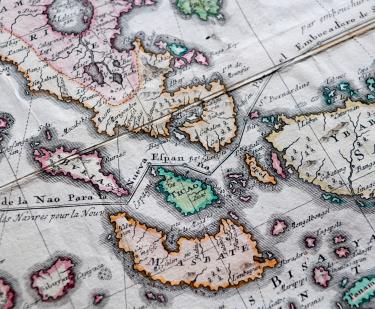
Carte Hydrographique & Chorographique des Isles Philippines…
Pedro Murillo Velarde
1760
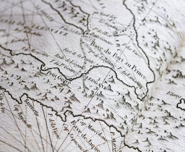
Le pilote de l'isle de Saint-Domingue et des débouquemens de cette isle…
1788
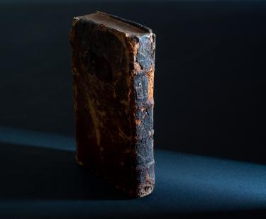
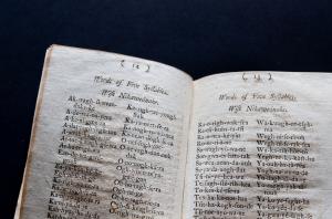
The Secretary's guide, or, Young mans companion
William Bradford
1728
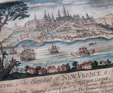
Quebec: The Capital of New France
Thomas Johnston
1759
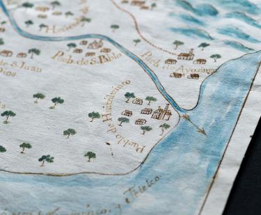
El presente mapa demuestra la cituacion, plano, y repartimiento, que en la actualidad tienen los arroyos, que bajan de Sierra Nevada…
Felipe de Zúñiga y Ontiveros
1770
Lettres d'une Peruvienne
Françoise de Graffigny
1748
Related
Collections Up Close
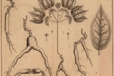
Ginseng in Canada?
Chris Parsons
August 1, 2008
Collections Up Close
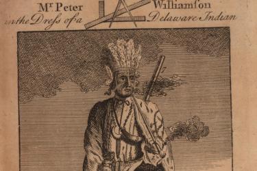
A Tale of Two Indians
Leslie Tobias Olsen
June 1, 2008
See Also
Pedagogical Materials
Manuscript