Skip to main content
Main navigation
News
Events
Exhibitions
1846: Inventing Americana at the John Carter Brown Library
Simon Bolivar, The Libertador
Upcoming Events
Past Events
Research
Using the Library
Instructional Support Guide
Requesting Materials
Resources and Publications
Image Permissions & Requests
Catalog
Fellowships
Opportunities
Fellows Directory
Life in Residence
Remote Fellowship Program
Visit
Visiting the JCB
Requesting Materials in the Reading Room
Collection Highlights
Places
Languages
Themes
Periods
Genres
About
Mission
Initiatives
History
People
Leadership
Staff Directory
Toggle Search
Search
Search
Search Menu
Online Catalogue (BruKnow)
Theme
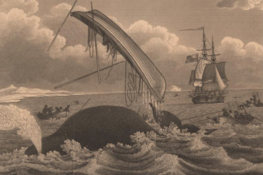
Maritime History
Share
Facebook
Twitter
Email
Featured Items
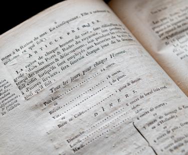
Composition de la ration des gens de mer
French Admiralty
1785
Principall navigations, voiages, and discoveries of the English nation
Edward Wright
1598
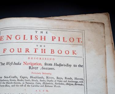
The English pilot, Book 4
William Fisher; John Thornton
1745
Neptune Americo-Septentrional contenant les côtes, les et bancs, les baies, ports, et mouillages,...
Buache de la Neuville
1780
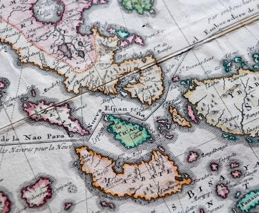
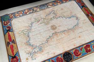
Carte Hydrographique & Chorographique des Isles Philippines…
Pedro Murillo Velarde
1760
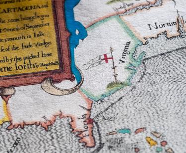
The famouse West Indian voyadge made by the Englishe fleete of 23 shippes and Barkes wherin weare gotten the townes of St. Iago, Sto. Domingo, Cartagena and St. Augustines
Baptista Boazio
1589
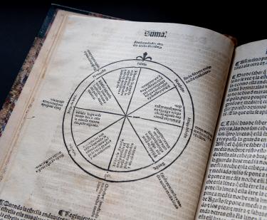
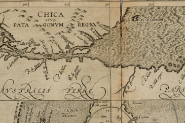
Suma de geographia...
Martin Fernandez de Enciso
1546
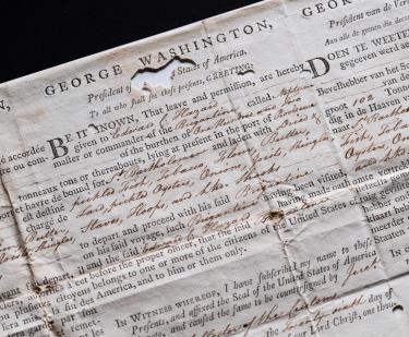
Sea letter, Brigantine Neptune, July 26, 1793
1793
Show More
Related
Fellow's Talk
Baleação e Escravidão: Conexões Atlânticas entre New England, África e Brasil. Séculos XVIII e XIX (in Portuguese)
Wednesday, September 22 at 1:00pm
Fellow's Talk
The Strait of Magellan and the Construction of a Global habitability. Geopolitics and cosmography in the 16th century [in Spanish]
Wednesday, June 30 at 1:00pm
Gateway to a New World
July-October 2019
See Also
Africa
Cosmography and Astrology