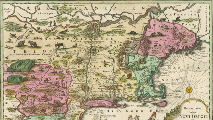
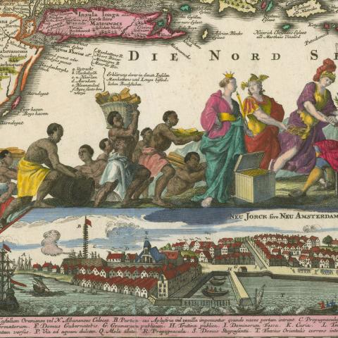
Recens Edita totius Novi Belgii, in America Septenrionali…, 1730

To launch the JCB’s new ‘Map of the Month’ feature, we have chosen one of the most dramatic and decorative maps of New England and the Atlantic seaboard ever issued. Researcher-in-Residence Chet Van Duzer has been studying this map for his current research project on map cartouches, which he will present in a lecture on December 12, 2019.
First published in the mid-seventeenth century by Jan Janson in Amsterdam to show accurately and in detail the extent and nature of the New Netherland, New England and Virginia colonies, this map stayed in circulation for almost a century. It went through many publishers and many changes well past the point after which New Netherland – or the ‘Novi Belgii’of the title – no longer existed. The JCB owns a dozen editions of this map, none, however, as embellished and as rich in iconographic representation as this vibrantly hand-colored 1730 edition, published in Augsburg by Matthias Seutter. The cartouche and allied decorative matter almost overwhelm the purely cartographic elements of the map: a line of indigenous people and enslaved Africans bearing the extracted resources of the colonies as tribute mounts the frame of an inset map located below the cartouche proper. This line is headed by Hera, Athena (goddess of wisdom) and Hermes (god of trade) who present this wealth to the seated George II. The inset map below of New York City is known as the “Restitutio View,” as it had been added to the map in 1673 to celebrate the brief re-occupation of New York by the Dutch.
[Matthias Seutter,] “Recens Edita totius Novi Belgii, in America Septenrionali…,”1730
