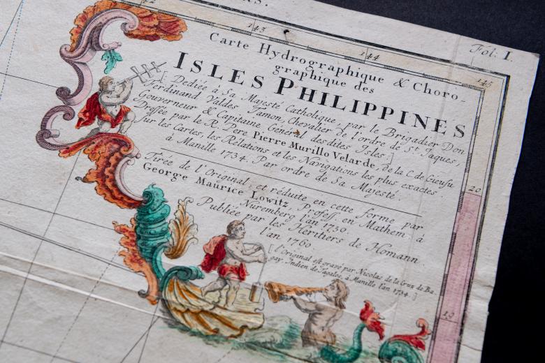
Carte Hydrographique & Chorographique des Isles Philippines…
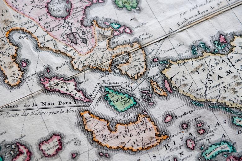
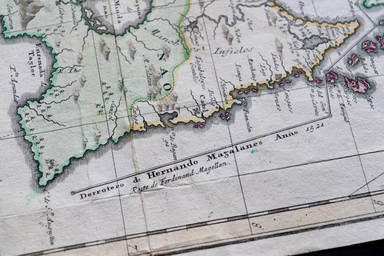
In 1734 in Manila, the Jesuit Pedro Murillo Velarde drew a magnificent map of the Philippines, on which this JCB map is based. The Velarde map was engraved and printed by Nicolas de la Cruz Bagay, an indigenous Tagalog who was the official printer of the Jesuit press in the Philippines, and it was the most ambitious and detailed map of the archipelago yet produced. The map combined enormous coastal and topographical detail with the attributes of a sea chart, showing the sailing courses for vessels heading to both Spain (Madrid) and New Spain (Mexico), as well as the course taken by Magellan in 1521. Velarde’s map was frequently copied, including by George Lowitz, a German mathematician who reduced the map’s size so it could be included in a 1759-60 atlas published in Nuremberg, the origin of the map now owned by the JCB.


