Skip to main content
Main navigation
News
Events
Exhibitions
1846: Inventing Americana at the John Carter Brown Library
Simon Bolivar, The Libertador
Upcoming Events
Past Events
Research
Using the Library
Instructional Support Guide
Requesting Materials
Resources and Publications
Image Permissions & Requests
Catalog
Fellowships
Opportunities
Fellows Directory
Life in Residence
Remote Fellowship Program
Visit
Visiting the JCB
Requesting Materials in the Reading Room
Collection Highlights
Places
Languages
Themes
Periods
Genres
About
Mission
Initiatives
History
People
Leadership
Staff Directory
Toggle Search
Search
Search
Search Menu
Online Catalogue (BruKnow)
Theme
Urbanism
Share
Facebook
Twitter
Email
Featured Items
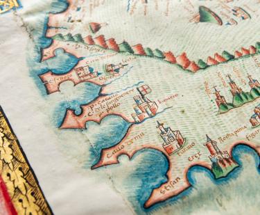
[Portolan atlas] / Vesconte de Maiolo ciuis Janue conposuy
Vesconte Maggiolo
1511
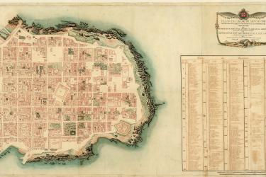
Guia política, eclesiástica y militar del Virreynato del Perú
Hipólito Unanue
1795
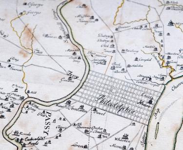
A map of Philadelphia and parts adjacent..
Nicholas Scull
1752
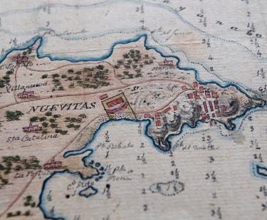
Plano del Puerto de Nuevitas en la Costa Norte de la Isla de Cuba levantado para mejor conocimiento por orden del Dto. Maritimo
circa 1828
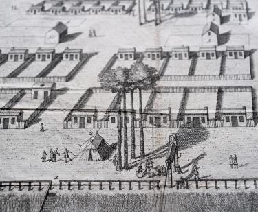
A View of Savanah as it stood the 29th of March. 1734
Peter Gordon
1734
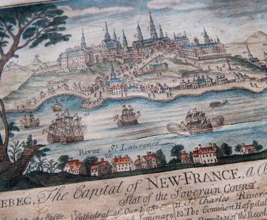
Quebec: The Capital of New France
Thomas Johnston
1759
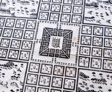
A plan representing the form of setling the districts, or county divisions in the Margravate of Azilia
1717
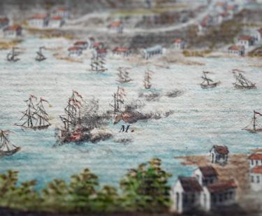
Prise de l'isle de la Grenade...
Roger fils
1782
Show More
Related
Fellow's Talk
Earthquakes and Timekeeping Practices in New England, 1600-1800
Wednesday, August 25 at 1:00pm
Bodies of Water/Bodies at Work
Summer - Fall 2018
Our Fellows
John F. López, NEH Fellow
March 8, 2018
Collections Up Close
Montevideo: A City Between Empires
Fabrício Prado
September 1, 2008
See Also
17th Century
French